
Monitoring Program Data View Archives
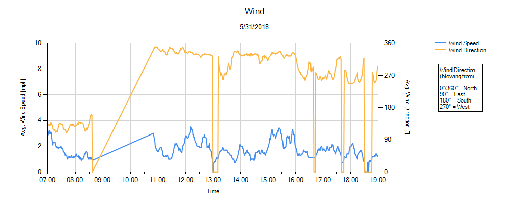
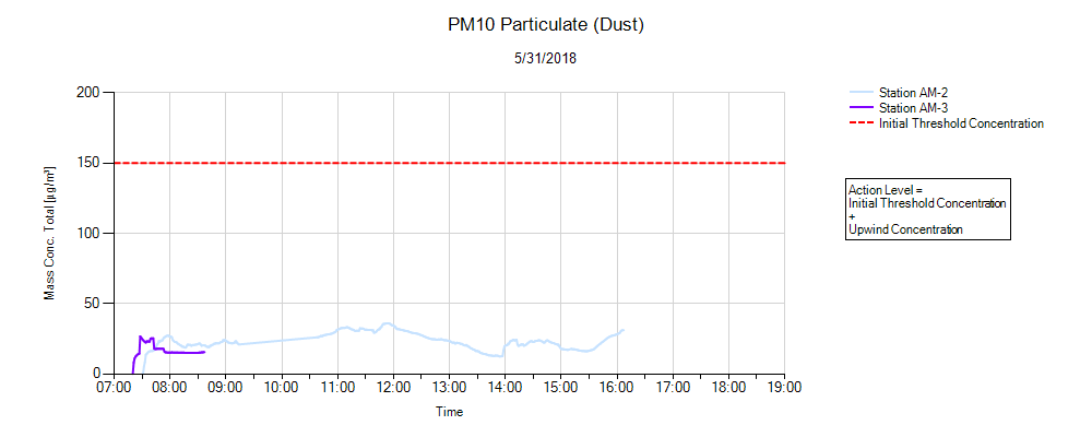
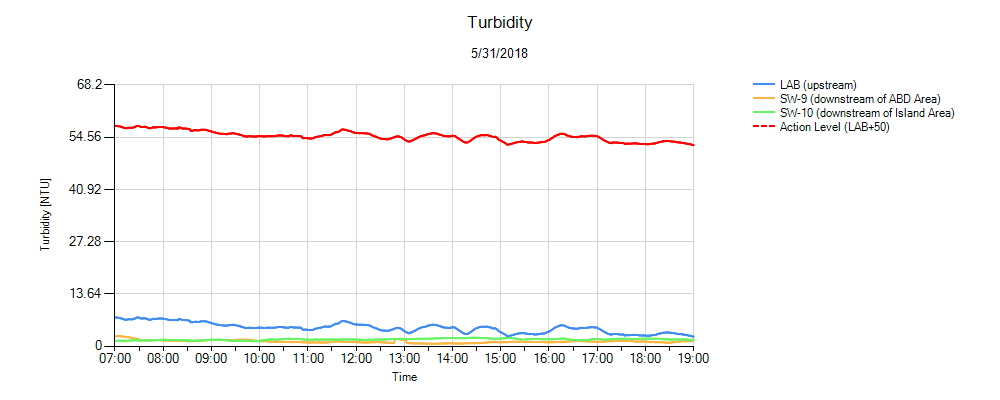
Environmental monitoring of surface water (turbidity), air (dust and mercury vapor), and noise was conducted in accordance with the CMI work plan during the removal phases of the remediation program. Chemours is committed to sharing monitoring data (turbidity, dust, mercury vapor) collected during remedy implementation with the community. The graphs below contain data from the various monitoring locations around the project area.1. Wind Monitoring
Click Image to Enlarge
Comments
The weather station was moved during the mid-morning timeframe in order to accommodate restoration activities beginning along Lakeside Avenue (i.e., removal of fencing where station was secured).
2. PM10 Particulate (Dust) Monitoring
Click Image to Enlarge
Comments
Monitoring station AM-3 was removed in the morning in order to accommodate restoration activities beginning along Lakeside Avenue. Moving forward, monitoring station AM-2 will be set up as a “mobile” station in that it can be moved to different locations each day (depending on where the majority of work is being completed) for recording dust concentrations.
3. Mercury Vapor Monitoring

Click Image to Enlarge
Comments
Dredging and sediment processing complete – mercury vapor monitoring no longer being conducted.
4. Turbidity Monitoring
Click Image to Enlarge
View Archives