Monitoring Program Data View Archives
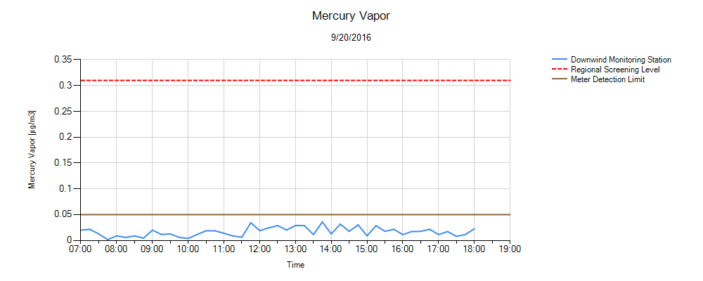
Environmental monitoring of surface water (turbidity), air (dust and mercury vapor), and noise was conducted in accordance with the CMI work plan during the removal phases of the remediation program. Chemours is committed to sharing monitoring data (turbidity, dust, mercury vapor) collected during remedy implementation with the community. The graphs below contain data from the various monitoring locations around the project area.1. Wind Monitoring
Click Image to Enlarge
2. PM10 Particulate (Dust) Monitoring
Click Image to Enlarge
Comments
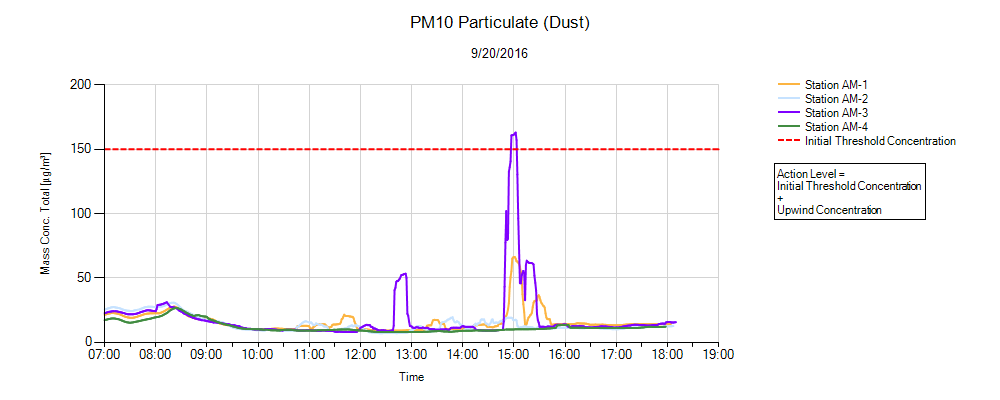
In reviewing the data, specifically around the elevated reading that occurred at approximately 1500, it appears that there was likely a diesel vehicle or piece of equipment idling in the area of monitoring station AM-3.
There were no dredging or truck loading activities that occurred in the area of this monitoring station during the day.
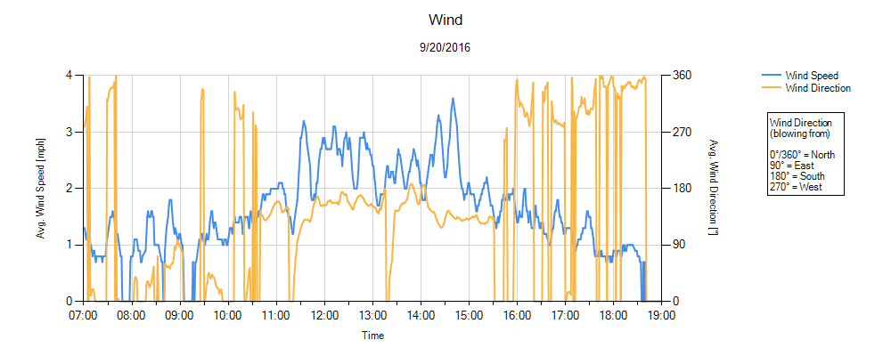
The local wind during this timeframe was from the southeast (from the lake towards Lakeside Avenue). Therefore, monitoring station AM-3 would have been considered as side gradient. Stations AM-1 and AM-2 would have been considered downgradient and are both located closer to the dredging operations and truck loading operations for the day.
3. Mercury Vapor Monitoring
Click Image to Enlarge
4. Turbidity Monitoring
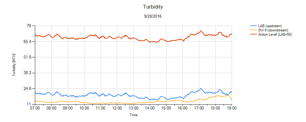
Click Image to Enlarge
View Archives

